Photographe.
Résultats de la recherche : "Paimbœuf" 2055 résultats
Notice d'illustration
IVR52_20054400388NUCA
|
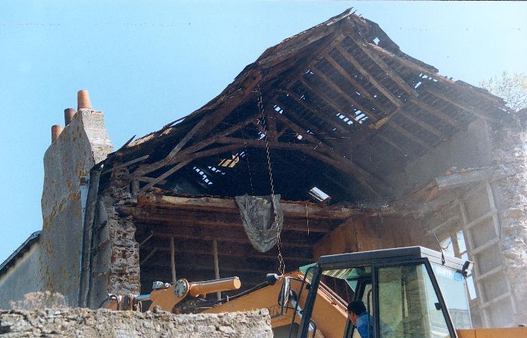
Immeubles à logements, hôtel de voyageurs, maisons (détruits), 4 à 10 rue Pasteur, Paimbœuf
Démolition des maisons situées à l'ouest de la rue Pasteur, détail d'une charpente.
Notice d'illustration
IVR52_20054400390NUCA
|
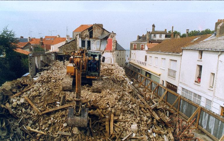
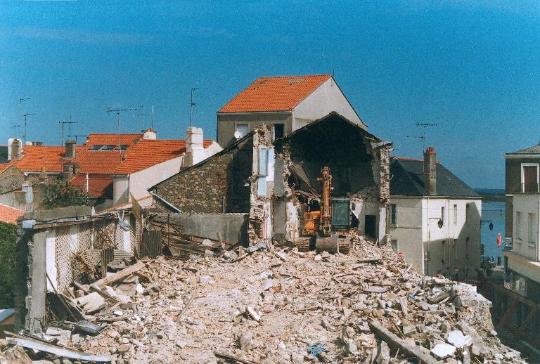
Immeubles à logements, hôtel de voyageurs, maisons (détruits), 4 à 10 rue Pasteur, Paimbœuf
Vue du chantier de démolition de l'ensemble des maisons situées à l'ouest de la rue Pasteur.
Notice d'illustration
IVR52_20054400389NUCA
|
Immeubles à logements, hôtel de voyageurs, maisons (détruits), 4 à 10 rue Pasteur, Paimbœuf
Vue du chantier de démolition de l'ensemble des maisons situées à l'ouest de la rue Pasteur.
Notice d'illustration
IVR52_20034402139NUCA
|
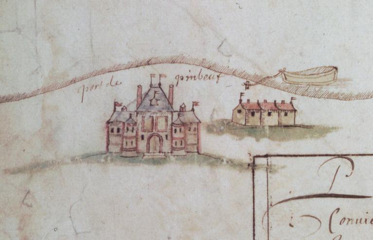
Ville de Paimbœuf
Carte d'arpentage des îles de la Loire depuis Ingrande jusqu'à Paimboeuf, 1665, détail : le port de Paimboeuf.
Notice d'illustration
IVR52_20044400026NUCA
|
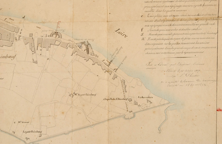
Ville de Paimbœuf
Plan du port de Paimboeuf et de des abords, par Plantier, 1837, détail du haut Paimboeuf.
Petot Frédéric (reproduction)
Petot Frédéric (reproduction)
Cliquez pour effectuer une recherche sur cette personne.
Notice d'illustration
IVR52_20034401795NUCAB
|
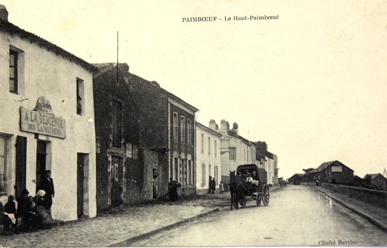
Ville de Paimbœuf
Le haut Paimboeuf, quai Edmond-Libert.
Notice d'illustration
IVR52_20034401808NUCAB
|
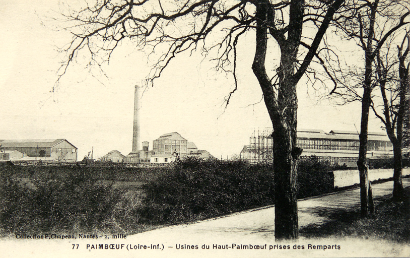
Ville de Paimbœuf
Le haut Paimboeuf, le secteur industriel.
Notice d'illustration
IVR52_20054402143NUCA
|
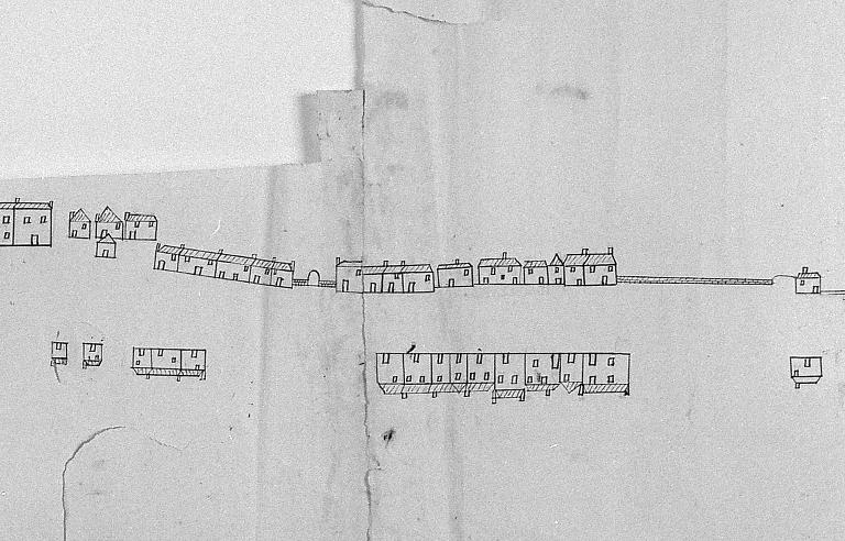
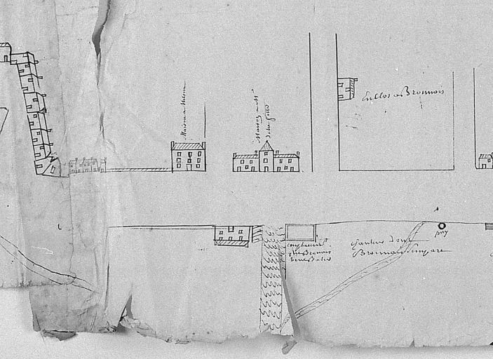
Les maisons et immeubles de la commune de Paimbœuf
Brouillon du plan figuré de Paimboeuf, [1749], détail (2) : le haut Paimboeuf.
Notice d'illustration
IVR52_20054402144NUCA
|
Prison, 14 rue Pierre-Chevry, Paimbœuf
Brouillon du plan figuré de Paimboeuf, [1749], détail : le haut Paimboeuf, au centre (inversée) la prison.
Notice d'illustration
IVR52_20054402145NUCA
|
Îlot 1, quai Albert-Chassagne ; quai Edmond-Libert ; chemin des Jardins
Brouillon du plan figuré de Paimboeuf, [1749], détail : le haut Paimboeuf.
Notice d'illustration
IVR52_20104401301NUCA
|
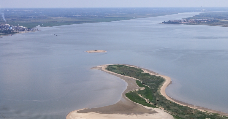
Ville de Paimbœuf
Vue aérienne 2010, l'estuaire avant Paimboeuf (arrière-plan à droite).
Notice d'illustration

IVR52_20034400111NUCA
|
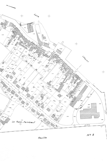
Maison, 16 quai Gautreau, Paimbœuf
Plan cadastral, 1999, extrait.
Notice d'illustration
IVR52_20054402146NUCA
|
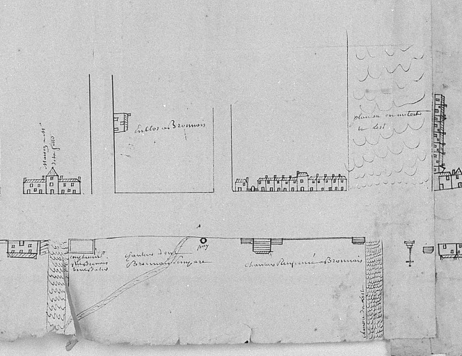
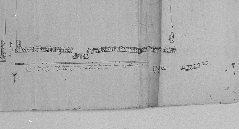
Îlot 4, rue Docteur-Colomb ; rue Pitre-Chevalier ; rue Eugène-Durand ; rue Florent-Gariou, Paimbœuf
Brouillon du plan figuré de Paimboeuf, [1749], détail : le port.
Notice d'illustration
IVR52_20054402142NUCA
|
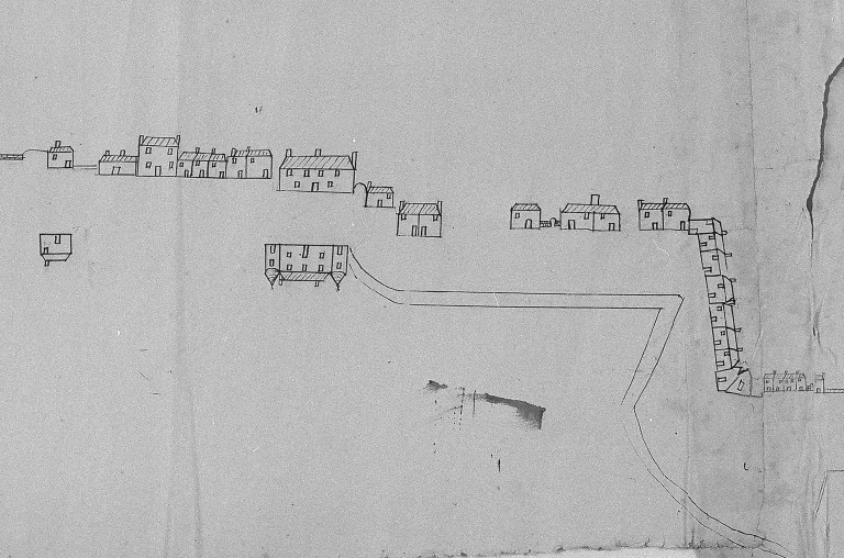
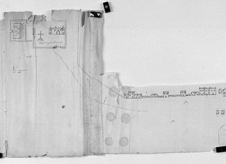
Les maisons et immeubles de la commune de Paimbœuf
Brouillon du plan figuré de Paimboeuf, [1749], détail (1) : la chapelle du haut Paimboeuf, l'extrémité est de la rive.
Notice d'illustration
IVR52_20034400119NUCA
|
Maison, 15 quai Edmond-Libert, Paimbœuf
Plan cadastral, 1999, extrait.
Notice d'illustration
IVR52_20054402150NUCA
|
Maison, 4, 5 quai Eole, Paimbœuf
Brouillon du plan figuré de Paimboeuf, [1749], détail : la rive à l'ouest.
Notice d'illustration
IVR52_20054400332NUCA
|
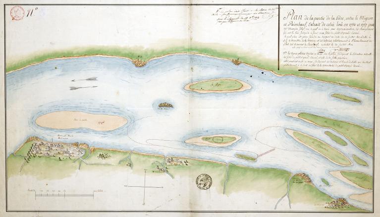
Paimbœuf : présentation de l'aire d'étude
La Loire entre le Migron et Paimboeuf, carte actualisée en 1812 d'après une carte établie en 1757 par Magin.
Notice d'illustration
IVR52_20114400674NUCA
|
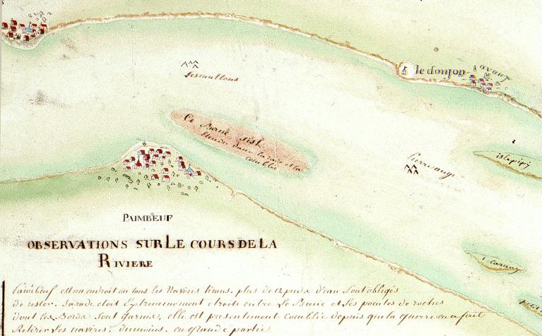
Paimbœuf : présentation de l'aire d'étude
Carte de l'embouchure de la Loire commentée, [1770], détail : le port de Paimboeuf.
Giraud Patrice (reproduction)
Cliquez pour effectuer une recherche sur cette personne.
Giraud Patrice (reproduction)
Photographe au Service de l'Inventaire général.
Notice d'illustration
IVR52_20034401475NUCA
|
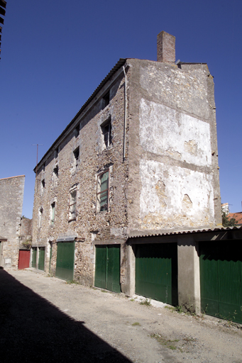
Maison, impasse Forest, Paimbœuf
Vue d'ensemble.
Photographe.