Photographe.
Résultats de la recherche : "Paimbœuf" 2129 résultats
Notice d'illustration
IVR52_20034400108NUCA
|
Maison, 14 et 16 rue Pitre-Chevalier, Paimbœuf
Plan cadastral, 1999, extrait.
Pillet Denis (reproduction)
Pillet Denis (reproduction)
Cliquez pour effectuer une recherche sur cette personne.
Notice d'illustration
IVR52_20034402131NUCAB
|
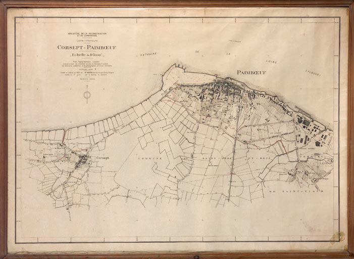
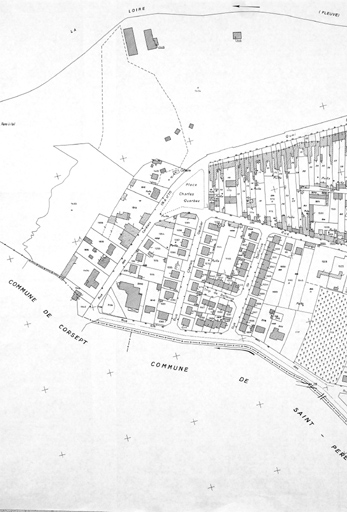
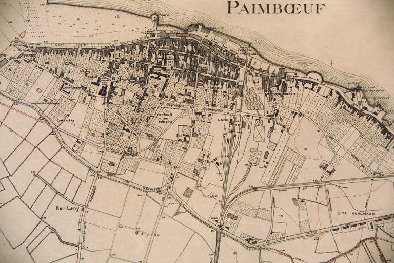
Ville de Paimbœuf
Plan topographique de Corsept et Paimboeuf, ministère de la Reconstruction et de l'Urbanisme, par Maupou, 1950.
Notice d'illustration
IVR52_20034402130NUCA
|
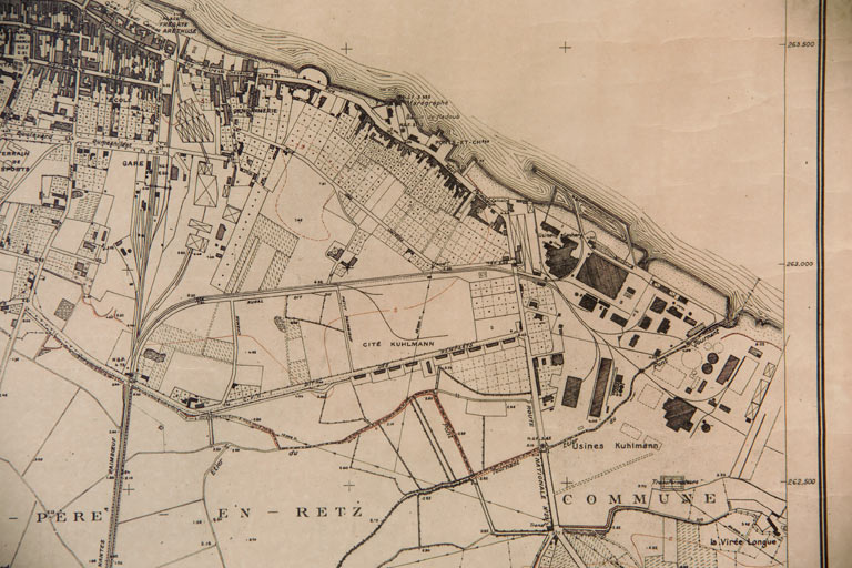
Ville de Paimbœuf
Plan topographique de Corsept et Paimboeuf, MRU, par Maupou, 1950, détail.
Notice d'illustration
IVR52_20034400109NUCA
|
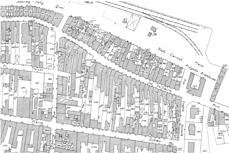
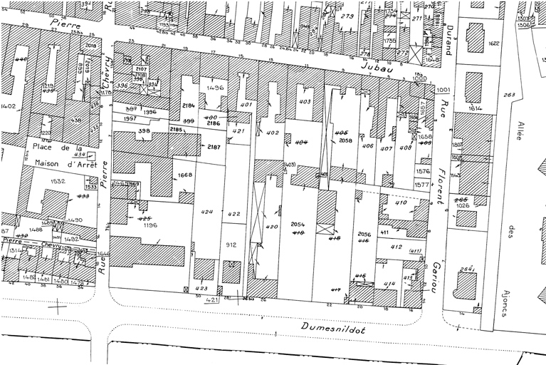
Îlot 7, rue du Général-De-Gaulle ; rue Pasteur ; rue Pierre-Jubau ; rue Eugène-Durand, Paimbœuf
Plan cadastral, 1999, extrait.
Notice d'illustration
IVR52_20034400154NUCA
|
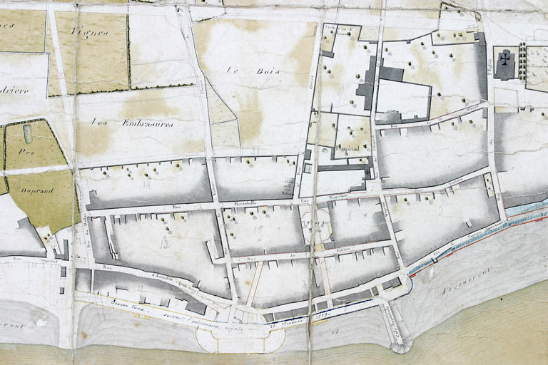
Ville de Paimbœuf
Plan d'alignements, par Caillard, 19 juin 1810, détail du bas Paimboeuf.
Notice d'illustration
IVR52_20034400128NUCA
|
Cité ouvrière, Paimbœuf
Plan cadastral, 1999, extrait.
Notice d'illustration
IVR52_20034400132NUCA
|
Lotissement du Bois Gautier, Paimbœuf
Plan cadastral, 1999, extrait.
Notice d'illustration
IVR52_20034400103NUCA
|
Corderie (détruite), 4 à 10 rue des Cordiers, Paimbœuf
Plan cadastral, 2002, extrait.
Notice d'illustration
IVR52_20034400134NUCA
|
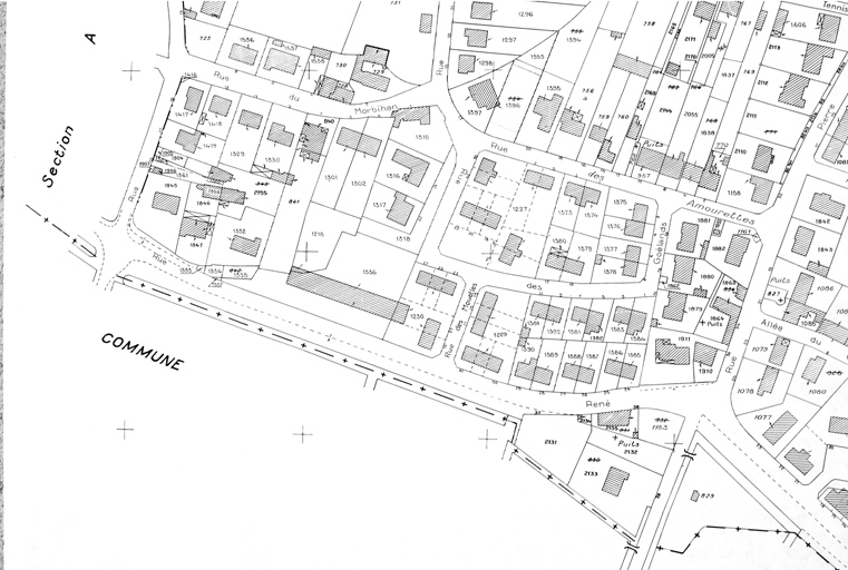
Lotissement des Amourettes, Paimbœuf
Plan cadastral, 1999, extrait.
Notice d'illustration
IVR52_20034400161NUCA
|
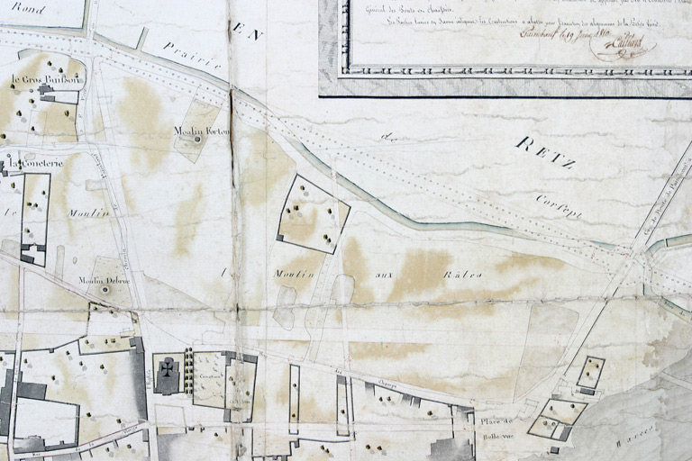
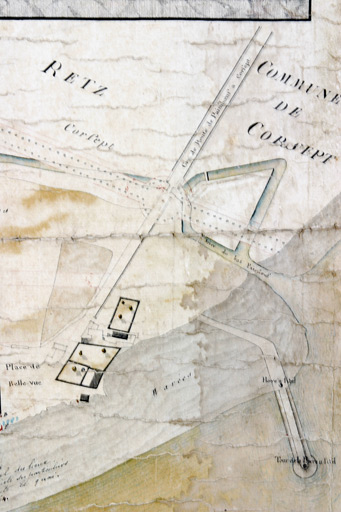
Lotissement de Bellevue, Paimbœuf
Plan d'alignement, 1810, extrait.
Notice d'illustration
IVR52_20034400106NUCA
|
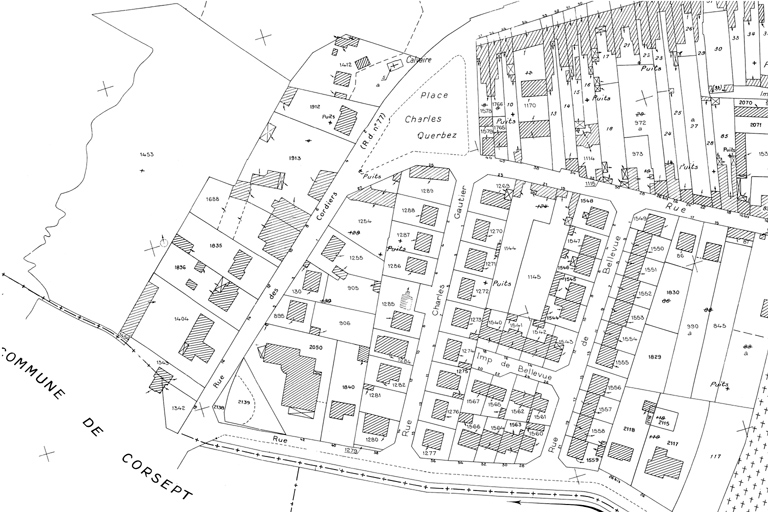
Lotissement de Bellevue, Paimbœuf
Plan cadastral, 1999, extrait.
Notice d'illustration
IVR52_20034400152NUCA
|
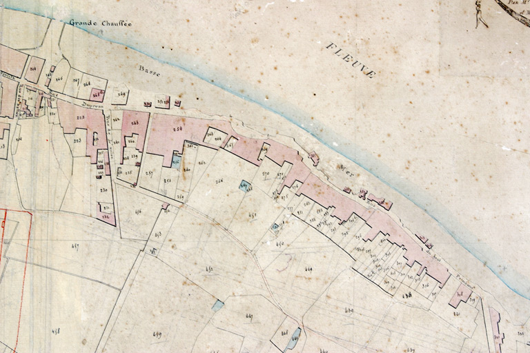
Jetée, quai Boulay-Paty, Paimbœuf
Plan géométrique de la ville de Paimboeuf, 1810, détail de la jetée dite de la Pierre à l'oeil.
Notice d'illustration
IVR52_20034400112NUCA
|
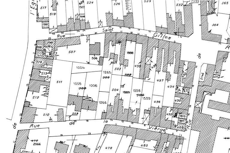
Maison, 9 rue Saint-Gilles, Paimbœuf
Plan cadastral, 1999, extrait.
Notice d'illustration
IVR52_20074401103NUCA
|
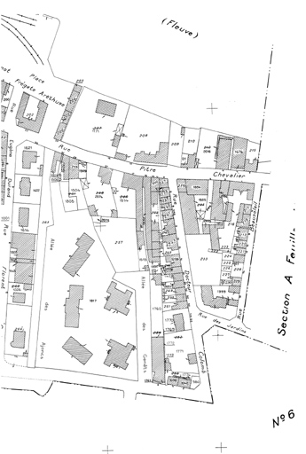
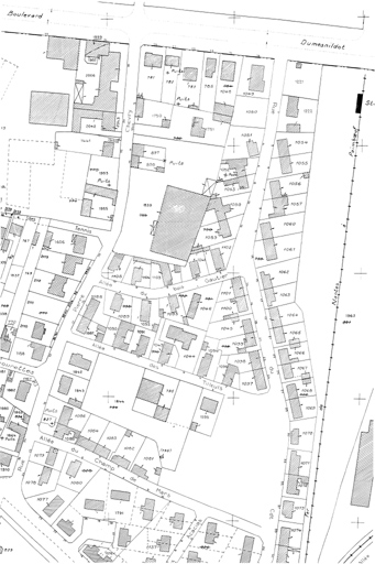
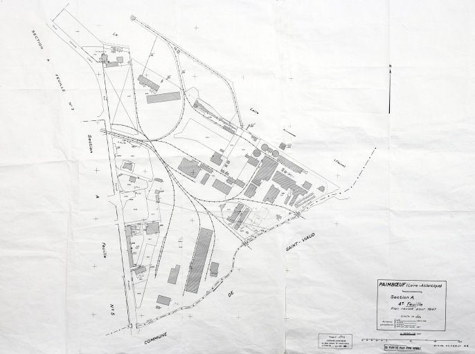
Ville de Paimbœuf
Plan cadastral, section A, 4e feuille, validé en 1999.
Notice d'illustration
IVR52_20094401323NUCA
|
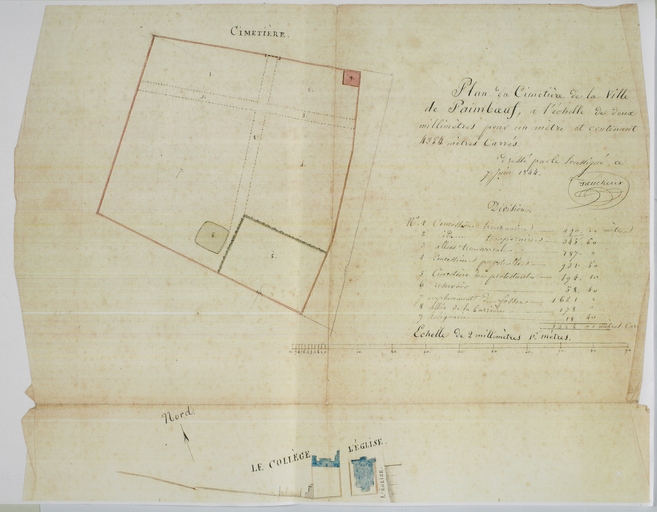
Cimetière, rue Pronzat, Paimbœuf
Plan du cimetière, détail, 1844.
Notice d'illustration
IVR52_20034400139NUCA
|
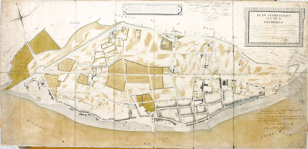
Ville de Paimbœuf
Tableau d'assemblage du plan cadastral, 1810, partie amont.
Notice d'illustration
IVR52_20034400115NUCA
|
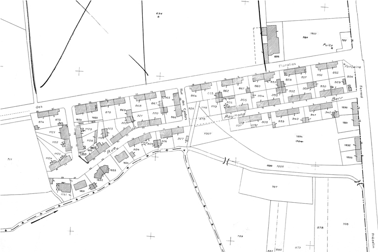
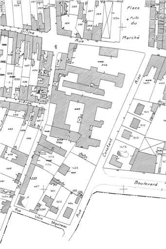
Lotissement concerté, 1 à 35 rue Pierre-Jubau ; 2 à 12 rue Pierre-Chevry ; 1 à 7 rue Pierre-Chevry, Paimbœuf
Plan cadastral, 1999, détail (Est).
Notice d'illustration
IVR52_20034402129NUCA
|
Ville de Paimbœuf
Plan topographique de Corsept et Paimboeuf, MRU, par Maupou, 1950, détail.
Notice d'illustration
IVR52_20034400149NUCAB
|
Ville de Paimbœuf
Plan d'alignements, par Caillard, 19 juin 1810.
Notice d'illustration
IVR52_20034400113NUCA
|
Maison, 7 rue de Bel-Air, Paimbœuf
Plan cadastral, 1999, extrait.
Photographe.